LINE 3348
Grid zone: 55 · E 501 842.310 · source context retainedAFTER PROCESSING · BEFORE PROFESSIONAL SIGN-OFF
A set of working survey review tools: a rule-based QA engine, a report reader that links line-level findings to their source lines, and eight browser tools. I designed, built and tested them in my own time.
Runs on example data. Advisory only; a registered surveyor still reviews and signs off.
Report Reader trace
Grid zone: 55 · E 501 842.310 · source context retainedDeclared zone and coordinate context need review.
The attention item keeps line 3348 attached; it does not decide the intended project zone.
Confirm the intended zone against project control and surveyor instructions before downstream export.
Traverse misclose, grid-to-ground, COGO, level loops and more. Each tool runs in your browser, shows its method and uploads nothing you type.
Join, radiate and polygon area from grid coordinates, with the full working shown for every step — including the grid-vs-ground area note. Free advisory working aid.
Point and line scale factor, height factor and combined scale factor for MGA2020 — convert grid and ground distances both ways with the full working shown.
Linear and angular misclose, relative precision and an advisory Bowditch comparison. Tolerance guidelines are read from loaded advisory rule packs, never hardcoded.
Loop misclose against a project-selected C√K guideline grouping, with advisory distribution and the full working shown; no survey order or jurisdiction is inferred.
Advisory duplicate-id, coincident-point, easting/northing-order and zone-extent checks with browser-local parsing and a bundled fictional example.
Geographic ↔ MGA2020 grid with zone, point scale factor and grid convergence shown, explicit GDA94 lineage and method selection, and a copyable method statement for every result.
A printable, per-state checklist of questions to ask before a survey package leaves the office. Advisory prompts only — it never decides anything for you.
Paste header blocks from project files to compare datum, zone, geoid and epoch declarations in one consistency table. Advisory — confirm against the source files.
Screenshots from the working build, all on fictional survey data. Open any card to use the real thing.
 Synthetic preview
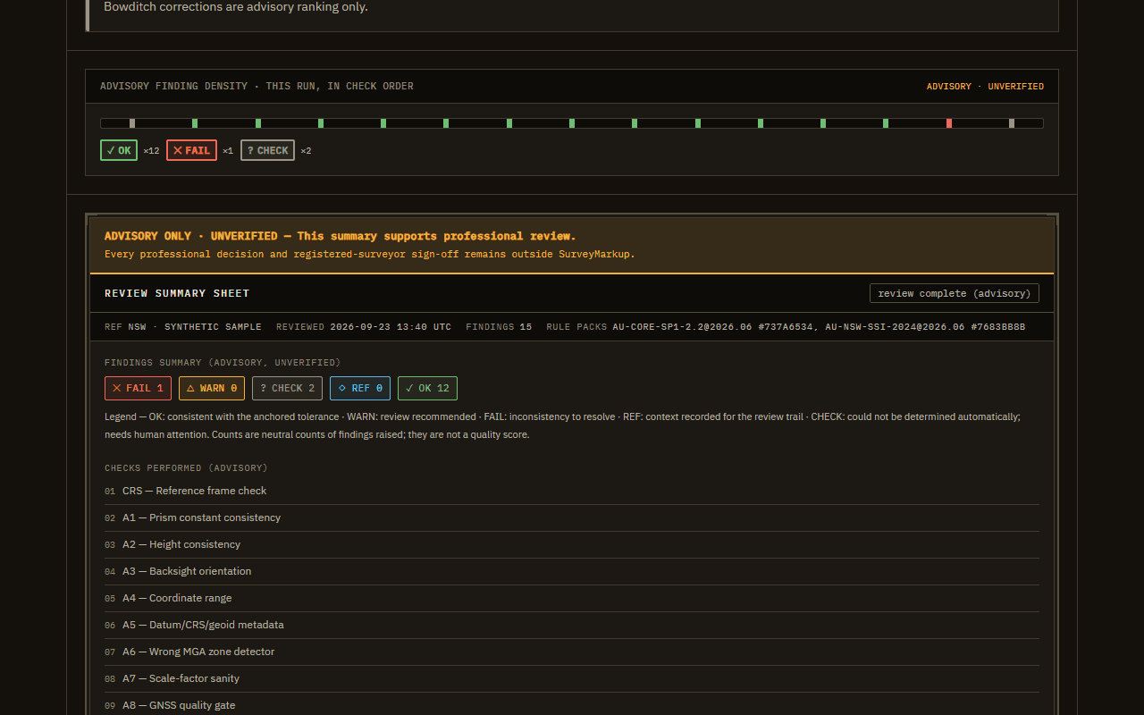
Runs deterministic rule-pack checks with evidence, provenance and explicit unexamined coverage.
 Synthetic preview
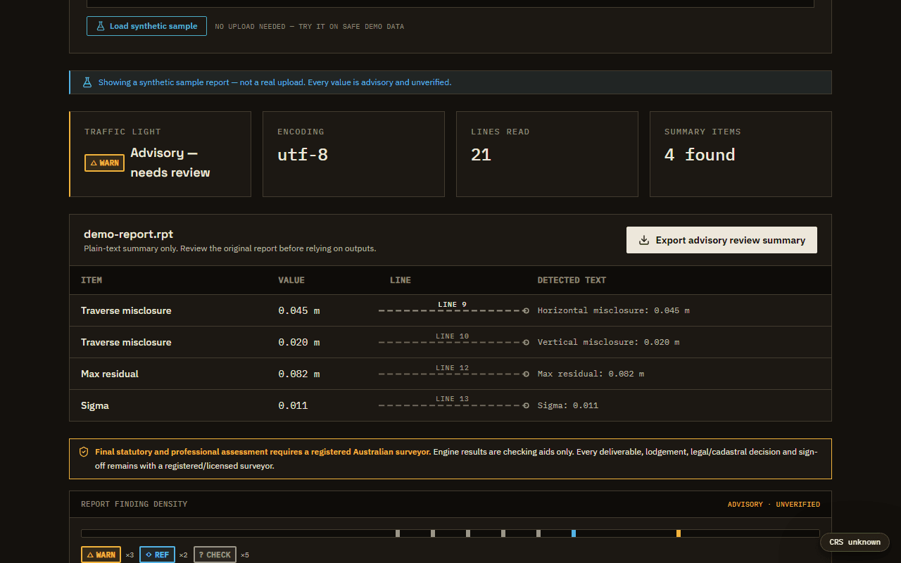
Reads supported report text, keeps attention items tied to source lines and exposes what was not examined.
 Synthetic preview
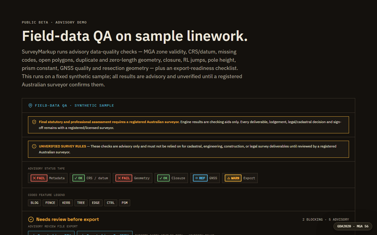
Presents coded linework, zone context, local checks and export provenance in a survey-focused map workspace.
My background is field and office survey work: high-rise set-out, cadastral, subdivision and detail surveys with Trimble S7 and R6, 12d Model and AutoCAD. SurveyMarkup turns common end-of-job checks into software: the geometry, the QA rules, the API, the browser tools and the deployment, built in my own time with AI coding assistants and every change reviewed and tested.
The rules follow published standards (ICSM SP1 and the NSW survey regulation packs) plus common end-of-job checks for set-out, cadastral and detail work.
Next.js and TypeScript in front; Python, FastAPI, PostgreSQL and Redis behind; Docker in production.
More than 3,000 automated backend, frontend and browser tests, plus accessibility and render sweeps on every release.
Example data, advisory-only wording and visible limits are deliberate. The registered surveyor keeps every decision.
Every result here is advisory. The tools organise evidence and flag what deserves a second look; a registered surveyor makes the call.